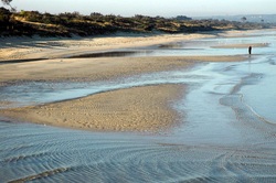
Seaford Foreshore

The 4.6 km long reserve runs along the east coast of Port Phillip Bay between Keast Park on the Kingston border to Mile Bridge, just north of Frankston. The 50 hectare reserve is classified as containing regionally significant coastal vegetation and is an important habitat corridor for birds, insects and reptiles.
Frankston City Council manages the Crown Land on behalf of the Department of Environment and Primary Industry.
The Reserve is accessed by designated entry points along Nepean Highway and a North/South track which runs the entire length of the reserve parallel to Nepean Highway. Fenced East/West tracks allow entry to the beach through the dunes, these are numbered for easy identification.
Council has installed emergency markers on the beach at the entrance to each East/West track these are linked to GPS co-ordinates.
Don't forget to check out our Facebook page for more up to date information and the ability to have your say.
